
Beryl just made history. It has forecasters concerned about what could happen next
Forecasters increase hurricane season predictions after Beryl
Beryl’s unprecedented performance only solidified a chorus of expert voices – including Klotzbach’s team at Colorado State – who called for a hyperactive hurricane season well before the first three named storms – Alberto, Beryl and Chris – formed.
“This early season activity is a likely warning sign that things are going to be very busy once we move closer to the peak of the season,” Klotzbach cautioned.
Klotzbach’s group of forecasters at Colorado State increased the number of named storms, hurricanes and major hurricanes expected this season in an update to their hurricane season forecast Tuesday. They now predict the Atlantic season will have 25 named storms including 12 hurricanes, half of which will become major hurricanes of at least Category 3 strength.
The forecast also relies on a burgeoning La Niña that should ease wind shear – the change in wind speed or direction at different heights in the atmosphere – over the Atlantic. High levels of wind shear can tear apart an active storm or prevent one from forming in the first place. Without it, more storms could form and strengthen.
But extremely warm water will stick around through the peak of hurricane season and storms could take full advantage of it to overcome wind shear, just like Beryl did.
The extremely warm water kept Beryl incredibly strong, even in the face of disruptive wind shear that should have weakened it considerably. This also happened during last year’s hurricane season when El Niño brought increased wind shear but incredibly warm water still helped 20 named storms form.
For now, a brief pause in Atlantic tropical activity is expected over the next week or two due in part to a large area of dry, dusty air and some bouts of moderately disruptive wind shear.
Plumes of dry air filled with Saharan dust traveling across the Atlantic from Africa are typical around this time of year. It can sometimes even reach the United States and help produce stunning sunsets.
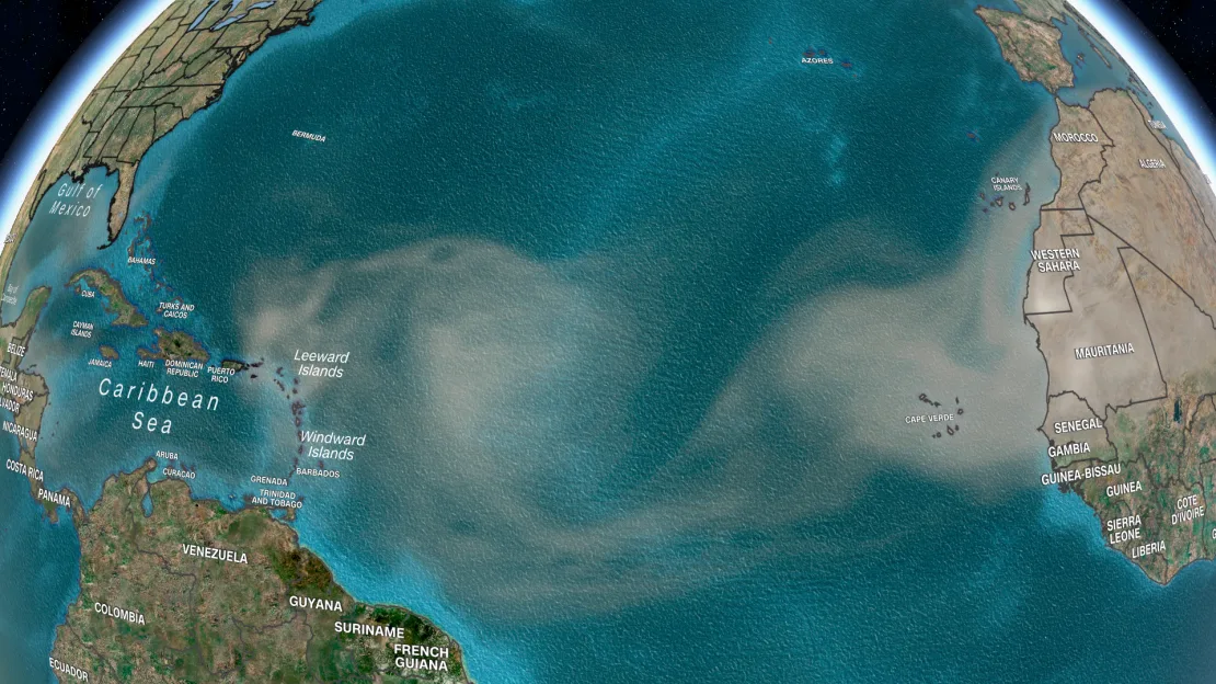
But dry, dusty air isn’t a friend to tropical systems. It cuts off the moisture a system needs to survive, so the National Hurricane Center isn’t highlighting any areas to watch for tropical development over the next week.
When the break will end and the busiest part of hurricane season will get underway is the “million dollar question,” according to Klotzbach. Tropical activity could ramp up again later in July or hold off until August depending on how several atmospheric factors play out in the next couple of weeks, he told CNN.
Either way, with such an extreme ocean heat to tap into, Beryl proved the door is wide open for a prolific season.
.png)

0 Comments